
Description
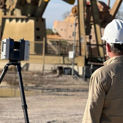
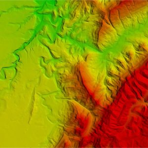
LiDAR technology emits laser pulses toward the Earth’s surface and measures the time taken for the signals to return. This data is used to generate detailed digital elevation models (DEMs) that reveal subtle geological features, including fault lines, fractures, and anticlines that may act as hydrocarbon traps. Airborne LiDAR is particularly useful in rugged terrains, where traditional mapping methods are challenging. It helps in identifying subsurface structures by detecting elevation changes linked to underground fluid migration. When combined with seismic data and geophysical studies, LiDAR improves the accuracy of reservoir predictions. The integration of LiDAR with AI-driven analytics enhances exploration efficiency by automating the detection of geological patterns and anomalies.

Usaini –
“I was impressed by the comprehensive nature of this guide. The information presented on LiDAR surveys was meticulously detailed and easy to grasp. It provided valuable insights into the technology and its applications in oil and gas exploration. The explanations were clear and supplemented with helpful illustrations, making it accessible to professionals of all levels. The guide proved to be an excellent resource in enhancing my understanding of LiDAR’s role in identifying potential hydrocarbon traps.”
Eunice –
“I was impressed by the comprehensive guide on LiDAR surveys. The clear explanations and detailed examples provided valuable insights into the technology’s application in oil and gas exploration. The high-quality images and data sets enhanced my understanding of how LiDAR data can reveal subsurface structures and support decision-making. This guide is an excellent resource for geologists and exploration professionals seeking to leverage this advanced survey technique.”
William –
“I was highly impressed with the ‘Oil and Gas Exploration Guides’ on LiDAR Surveys. They provided an in-depth understanding of how LiDAR technology can revolutionize mapping in our industry. The guides meticulously described the principles, applications, and benefits of LiDAR, enabling us to identify potential hydrocarbon traps with remarkable accuracy. The detailed explanations and insightful examples greatly enhanced our geological interpretation capabilities, leading to improved exploration decision-making.”